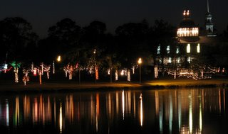
 Reflection from across the lake Reflection from across the lake | |
 Palm trees and Pink Flamingos Palm trees and Pink Flamingos | |
 Cat sleeping in front of the fireplace Cat sleeping in front of the fireplace | |
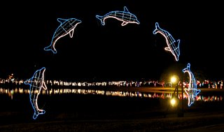 Leaping fish Leaping fish | View from across the lake |
 Reflection from across the lake Reflection from across the lake | |
 Palm trees and Pink Flamingos Palm trees and Pink Flamingos | |
 Cat sleeping in front of the fireplace Cat sleeping in front of the fireplace | |
 Leaping fish Leaping fish | View from across the lake |
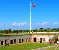
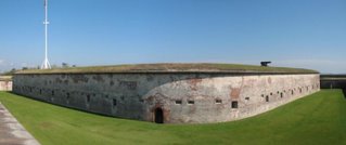
The next day was much better we when to Fort Macon, a quick History:
Construction of the fort began in 1826, it is a five-sided structure of brick and stone with twenty-six vaulted casements (rooms) with outer walls that are 4.5 feet thick, it was part of the chain of coastal fortifications for national defense. Its purpose was to guard Beaufort Harbor, North Carolina's only deepwater ocean port. It was named after state senator Nathaniel Macon, who procured the funds to build the facility. During its history it has seen Robert E Lee as an Army engineer, seized by the N. Carolina militia, retaken by Union forces to be used as a coal fueling station for the navy, a federal prison, closed in 1903, sold to the state of North Carolina to be used as a state park, restored by the Civilian Conservation Corps and then leased back to the military to be used during World War II.
When we left here to head south we drove past Camp Lejeune, for about four miles the road was lined with huge home made signs welcoming home the different soldiers and units, was really kind of neat.
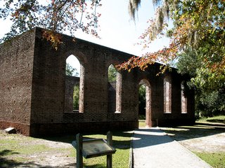
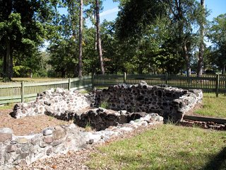
We stayed in Myrtle Beach for a week and did a drive north along the coast to Southport, while we were in the area we followed a few signs and found the Ghost of Brunswick Town, located on the banks of the Cape Fear River it was a British colony started in 1726. It was a major shipping port for the British until the colonist rebelled against the Crowns authority of tax stamps; this was eight years before they did it in Boston with the Boston Tea Party. In 1776 the British raided the town and burnt it to the ground. All that is left now are the foundations of about 50 different homes and buildings and the walls of the St. Phillips Anglican Church. Some of the town in on Army property (Sunny Point Army Base) and not assessable.
This is also the site of Fort Anderson built by the C.S.A. 1861 to defend the city of Wilmington; the fort was a large sand fortification with ten cannons. Today only the outer mounds of the fort remain.
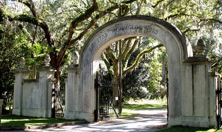
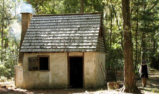

Descendants of the original family still reside at this site and are actively involved in heritage preservation at Wormsloe. There is a ton of history here but way too much to go into.
Onward to St Mary’s Georgia right on the Florida boarder were we had a ton of things planned to do, that is until I twisted my back, so this week ended up being Chiropractors, pain pills and rest.
 Click picture to enlarge
First the Bad News, Nick and Rachel had to go back to school so Cathy and I don’t have anybody to play with.
The Good News, we’re back on the road heading south for the winter, but we’re heading there very slowly.
Our first stop was in Wapakoneta, Ohio. A nice Coast to Coast resort with an indoor pool, hot tub and sauna, this helped heal a lot of sore muscle from the summer activities with the kids.
While cruising the back roads of the area we came across the little town of Zanesfield, this was the hometown of Dr. Sloan, you may have seen bottles of his elixir. It started out as a horse medicine but it work so well he took it on the road (the late 1800’s) advertising it for humans and became a millionaire selling his snake oil.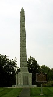

We cut across Ohio to the southeast corner and made camp there for a week. We got there just in time for the Mothman Festival in Point Pleasant, W Virginia. If you remember the movie from a few years ago the Mothman is a giant Moth/man with big red glowing eyes that flies around chasing people. This is the area were it was sighted many times, they have a three day festival with people coming from all over the world, many people who have sighted or came into contact with the Mothman attend and give talks and sign autographs. Thank goodness we got here a few days early and were able to explore the town without the crowd.
Our first stop was at Tu-Endie-Wie State Park (Wyandotte for “the point between two waters”); it’s located right at the confluence of the Kanawha & Ohio Rivers. 
The historical importance of this location is this is where the Battle of Point Pleasant took place on October 10, 1774, considered by many to be the first battle of the American Revolution; it pitted the Virginia militia led by Colonel Andrew Lewis against the British allied Indians, Shawnee, led by Chief Cornstalk. By the end of the day the Virginia militia was victorious but there were close to three hundred dead and hundreds more wounded.
This is a small park but it houses a 90 foot Obelisk honoring the militiamen who died in the battle, monuments to Chief Cornstalk and “Mad” Anne Bailey Taylor (more of her later) and the Mansion House (1796) which is now a museum housing many artifacts from the area including a hand written, signed letter from Danl Boone.
Anne Bailey, after her husband was killed in the battle, took to dressing in men’s clothing and became a great scout for the military. She would deliver messages and supplies through enemy Indian lines where no man would dare venture; she lived to be over 100 and is buried at this site.
There is another marker there that gives the history of Colonel Andrew Lewis, who led the militia to victory, it notes that his 5th Great Grandson, Major Edward White of Gemini 4, was the first American to walk in Outer Space. It made me think that here you are the First American to walk in Outer Space and you’re still not the most famous person in your family.
From the park we crossed the street and went to the Point Pleasant River Boat Museum. They have exhibits on the history of riverboats and river life in the area, including an old steamboat pilothouse. Upstairs they have a video on the “Silver Bridge Collapse” this was a bridge that crossed the Ohio River at 6th street which during rush hour traffic one day in December 1976 suddenly collapsed into the river killing over 50 people.
This is also the area of Morgan’s Raid during the Civil War and there are markers everywhere related to that event. We missed the five day re-enactment of the raid by two days, the next one is scheduled for 2013; we’ll try to make that one.


 Just a little bit out of order here, it seems as if I forgot all about West Virginia, we spent a week in a resort right across the street from Pipestem state Park. This is in the mountains and pretty much in the middle of nowhere but a very beautiful nowhere.We came across a lot of neat thing just wandering any road that we could find; the first was Pinnacle Rock St Park. This is a natural formation and is where the rocks when rising to form the mountains this section turn 90 degrees and shot up.Its probable about three hundred feet high and yes we did climb it, it took awhile and we had to make a lot of stops on the way up but we made it, did I mention that there are stairs on the other side. It's still a helluva climb but the view from up top is worth it, no picture you have to climb it yourself.
 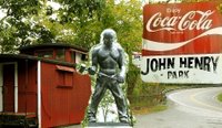 Another road took us to a little roadside park, which is right over top of the Big Bend Railroad Tunnel. This tunnel was started in 1870 and took three years to complete the entire mile, about half way through construction; the new steam drill was invented and brought to this sight. Everyone was amazed at the speed except for one man who challenged the drill and operator with his sledgehammer and chisel. The contest started and by the time it was over the man had beat the machine, he then walked a few feet away and dropped dead, giving us the legend and ballad of “John Henry the Steel Driving Man”. I’m not kidding we really found this place.
 While following a little road along side the Greenbrier River we found the Graham Cabin, built by Col.Graham in the 1770’s it was the site of a Shawnee Indian Attack in 1777 where is daughter was taken captive. The Col spent eight years following tips until he located and bought back his daughter.
Our last day in the resort we figured that we should drive across the street and see what was at the State Park and we’re glad we did, there are two lodges there one on the top of the mountain and the other in the bottom of the gorge. We decided to visit the one at the bottom of the gorge, a grueling three hours hike down the trail dug into the side of the mountain or a five-minute ride on the tram. 
The lodge is right on the Blue River and has a nice dining room and miles of trails if you’re up to it, we were just going to do lunch but of course the dining room is closed on Tuesdays. It was right about then that Cathy noticed the sign that said the tram shuts down at 1pm on Tuesdays, good thing cause we never would have made the six-hour hike out.
The nice thing that the lodge does is the Tram ride is FREE, on the way down, when you're ready to leave and you go back to the tram to get on their is a ticket booth, Four dollars a head to avoid the walk back up. Pretty tricky, but if you eat at the lodge the ride up is free.
 The Battle of Guilford Court House was fought on March 15, 1781, 1900 British troops under then command of Lord Cornwallis faced 4400 American militia and Continentals under the command of General Nathanael Greene. It is considered to be one of the most decisive Battles of the Revolutionary War. Greene set up three lines of defense against the advancing British, the battle started at 12:30 and ended after 2 1/2 hours of intense and brutal fighting with Cornwallis forcing Greene to withdraw from the battlefield and retreat. Although the British claimed victory by holding the battlefield at the end of the day, it was a costly victory. Cornwallis had lost over 25% of his troops, when the British Parliament learned of the battle, Charles James Fox exclaimed, "Another such victory would destroy the British Army.
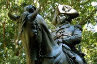
The first thing we did was go to the visitor’s center and watch the Battle Map Program, a lighted map show with narration that explains the movement of the troops and the timeline of the battle and a 20 minute film they have on the battle. There was another couple there at the same time, they started asking one of the volunteers a few questions and once she started talking about the battle there was just no stopping her, she went on for about an hour telling us a bunch of little things would never find out about if not for her.
We did the auto tour of the park which is in the middle of Greensboro (named after Nathanael Greene) but it seems like you’re out in the middle of the country. With all the stops and monuments in the park in turned out to be about an hour tour. We also found a monument marking the graves of two signers of the Declaration of Independence that buried here in the park.
 We decided to take a “Jump into History” which is how they describe it when you enter the Airborne & Special Operations Museum at Fayetteville N.C. It’s a good thing we had a large breakfast this morning because we ended up spending close to four hours here and missed lunch.The museum starts with the original concept of airborne troops in 1940, it explains the training of the first airborne troops and then follows them into WWII and the first airborne assault in North Africa, then Sicily, Italy, Jedburgh, Normandy, D-Day and then onto the Pacific theater. It covers every battle and assault that an airborne troops was ever involved in.
 We got to walk through the fuselage of a C-47 transport, while overhead there is a full C-47 with troops parachuting out. They have it set up like a
  Since we were in the area and it was going to be a freebee we decided to go to the N. Carolina State Zoo in Asheboro. The zoo has nearly doubled in size since the last time we were here ten years ago. They made it so big they have two parking lots about a mile and a half apart so now you can just enter one end walk through the zoo and come out at the other were a shuttle bus is waiting to take you back to your car. Saves you from walking back thought the zoo to get to your car. They were still doing a lot of construction but just about all the exhibits were open.
 amazing that I can still recall things that we saw 10 years ago that really stood out, but as I sit here now thinking I can’t come up with one outstanding thing we saw this time. I guess new and improved isn’t always better. If you have never been here before it would probably be a very enjoyable experience but if you were here before they redid it I would give it a pass.
If you have ever driven on I-77 in SE Ohio then you may have seen a sign on the side of the road that states “Crash site of the Shenandoah”, well there are three crash site and you have to get off onto the back dirt roads to find them all, so here we go.
First you have to find Ava, Ohio, then drive to the south end of town or the block, it’s a very small town, look for Raynor’s Service Center then look for a trailer next to it with Shenandoah printed across the front, this is it. 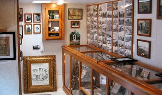 If it’s not open then step inside the Service Center and ask for Bryan, the owner, he’ll be more then glad to open it up for you and tell you all about the Shenandoah, Bryan is probably the most knowledgeable person on the Shenandoah there is.
Bryan’s grandfather started this business over 75 years ago and was present when the Shenandoah crashed. We found it hard to believe how much great stuff he was able to exhibit inside the trailer, this is the best little museums that we have visited.
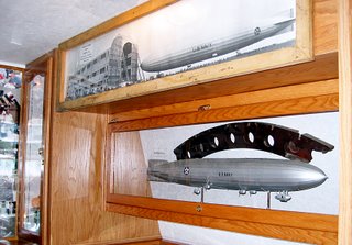 He has many hands on exhibits which include parts of the framing that were made from duralumin, lighter then aluminum and stronger then steel, he’ll hand you a piece and tell you to try and bend it, you can’t, pieces of the outer skin of the ship which feel thinner then a sheet of paper and pieces of the bladder that held the helium, called “goldbeaters skin” it was made from the lining of an oxen’s stomach, they needed over 750,000 oxen to make all the bladders. A bladder made from stomach just doesn’t sound right. Bryan can provide you with a map and directions to all three-crash sites if you want to hunt them down and now, the story of Captain Lansdowne and the Shenandoah.
Shenandoah, an Algonquian Indian word meaning “Daughter of the Stars” was the name chosen by the Navy for America’s first lighter-then-air dirigible. Commissioned in October 1923 she was 680-feet long, 78-feet in diameter and over 93-feet tall, her 5 Packard engines produced a total of 1625 horsepower allowing her to cruise at 50 knots. Total cost 2.9 million dollars (and that’s 1923 dollars). Not only was she the first rigid airship in America she was also the first to use helium and the first to be moored to a floating mast when she tied up with the USS Patoka during maneuvers
The Shenandoah had just started a 6-day publicity tour, when early September 3 1925 she ran into a terrible thunderstorm over southeastern Ohio. The strong winds tore the ship in two causing the control car to break away and fall to the earth near Ava, Ohio (Crash site 1). The stern section continued for about another mile before crashing in Ava, Ohio (Crash site 2). The bow still afloat and being blown by the strong winds, remained aloft for another 13 miles until a farmer managed to grab one of the lines and tied it off to an oak tree near Sharon, Ohio saving the lives of the seven crew members who remained aboard. Fourteen of the 43-crew members perished in the crash, among them was the Captain, Lt Commander Zachary Lansdowne, a graduate of the Naval Academy and who was born and raised in Greenville Ohio, less then 160 miles from the crash site. Ironically this was to be Lansdowne’s last flight, he was to be transferred to sea duty immediately following the end of this flight. Lt Commander Lansdowne told the Navy that he did not want to fly this route; being raised in this area he knew about the sudden storms that could come up during September and wanted a more southerly route. The Navy insisted on the original route.
Since we’re going to be in the area for a week we thought that we would seek them out; the first site we would have never found without Bryan’s directions. It’s located on his property; he is so into the Shenandoah that he bought the property to make sure it would always be remembered. This is where the ship broke in half causing the control compartment, which hangs under the ship to break away and fall to the earth. A few people survived this fall, but Captain Lansdowne landed on a fence post and was impaled, causing his death. Site #2 is on the interstate and we’re still trying to figure out how to get to it without stopping on the interstate and climbing the fence. There is a monument in Ava to commemorate the crash and list the names of those who died; this is normal considered site #2. Site #3 is about a 20 miles drive but since we were near another item that we were looking for and Bryan had given us directions to that we will now take a little detour (or Detour through History as Cathy would say).
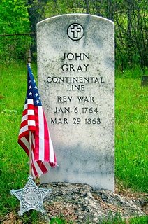 John Gray. What? You don’t know who he is? Well John Gray was born in 1764 at George Washington’s Mt Vernon, and lived there until he was old enough to join General Washington and his father in fighting the American Revolution. John’s dad was killed in battle during the Revolution; John managed to make it through all the battles and returned to Mt Vernon where he remained friends with the first President until George’s death. His life-long friendship with the First President is pretty unique, but what John is famous for is that he was the last survivor of the American Revolution in the nation, dying on March 29, 1868 at the age of 104. Two others laid claim to being the last survivor but research done near the time of John’s death proved that he was definitely the last one. If you think about it, George Washington was referred to as the “First soldier of the revolution” and here John, who was born on George Washington’s plantation at Mt Vernon, was the “Last soldier of the revolution” History sure can be funny when you look at it in the right way.
We took all the dirt roads, managed to find the little family cemetery where John is buried and paid our respects to an American Hero.
End of the detour, Ok now we’re back on the road looking for crash site number 3. We followed all the directions that Bryan gave us and found it without any problem at all; it’s right on the side of a county road and has two different markers. It’s also where the radar cop hides to catch all the speed racers that come through here.
 You think we’re done here, no way, Bryan told us to go a few miles past the crash site and look for something really big. He hasn’t steered us wrong yet; a few more miles it is. We rounded a turn in the road and saw a nice little roadside park with the biggest steam shovel bucket you could imagine. The Big Muskie was a mammoth size crane that was built specially to work in this strip coal mine. The crane itself was dismantled and sold for scrap, it weighed in at 27 million pounds, it was a diesel electric that produced over 52,000 horsepower, it averaged 18,000 kilowatts per hour or enough to provide 90% of the electrical needs of the city of Las Vegas. The bucket remains on display to remind people of the strip mining that took place in this part of Ohio. The bucket alone weighs 460,000 pounds, and was capable of holding 325 tons of coal. While we were there the caretaker who stays in a trailer, an old guy in his mid 70’s, came out to say hi, I told him that Bryan from the museum had sent us down here to see the bucket. He asked us if Bryan told us about the crash site down the road and we said that we just came from there. Then he asked if he told us the story of the farmer who grabbed a rope and tied the bow section off to an oak tree, and when I said that he had, he said that was his dad.
His dad was up early that morning because of the storm when he saw a big dark object floating overhead and he said that it was screaming at him, once he got over his fear of this big dark floating object screaming at him he realized that it was human voices that he was hearing, that’s when he grabbed one of the ropes hanging down and tied it off to a tree saving the lives of the seven crew members that remained aboard.
All this and we still managed to find a great little diner for lunch, I could continue with stories about Johnny Appleseed and the first oil well drilled in America but I’m getting tired so I’ll save those for later.
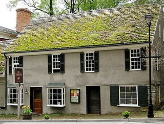 We did find The Tavern in Downtown Abingdon but it’s only open for dinner and very expensive at that, the reason I mention the Tavern is that it is the oldest building in Abingdon being built in 1779 and it was started by one of Cathy’s ancestors.

 They take you back in on one of the old electric mining cars and make about 5 stops at different parts of the mine to explain how things were done, after leaving the mine we toured the restored mining town that is on site there.
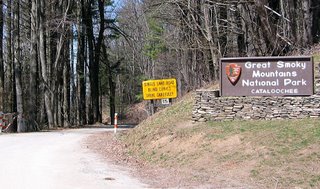
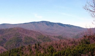 As it
As it


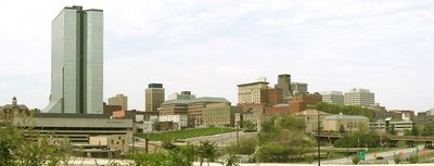
 Yesterday was a beautiful sunny day so we returned to the river and went to Volunteer Landing, where here is a mile and a half riverwalk with a few floating restaurants, some fountains and waterfalls for the kids to play in when its hot. There was quiet a few people down there biking and rollerblading and a few just sitting under one of the waterfalls. We tried on of the restaurants and watched the barges and paddle boats go by as we ate.
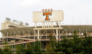
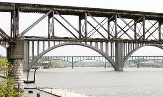 They have a lot of bridges down here, the one in the background was built in th e mid 1800's and is only one of three of this design that is still in use in the United States. If you continue down the walkway and cross another little stream you end up at Fort White which was the original Knoxville. They have restored the Fort and it's right in the middle of Downtownm there are also a few more original buildings and homes from the founding days. But the best thing in the downtown area or along the river or in the city or even in the entire state is the stadium that houses the ORANGE NATION FANS every Saturday during the fall, the birthplace of the great Peyton Manning. Believe it or not.